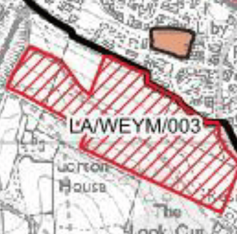
LA/WEYM/003 – Land South of Beverley Road (East)
This is a steep, open greenfield site (71 homes) on the ridge between Littlemoor and Preston. Dorset Council acknowledges that it is highly visible from the surrounding countryside and from within the Dorset Area of Outstanding Natural Beauty. The site forms part of a recognised wildlife corridor that connects to the Lorton Valley, with locally important habitats lying just beyond the southern boundary. Archaeological features have been recorded here, including cropmarks and an old lime kiln, and a public right of way runs across the field. Because of its height and exposure, any development would be seen from long distances and could change the green skyline that currently separates Weymouth from its rural backdrop.
An Area of Outstanding Natural Beauty (AONB) is a nationally protected landscape, its conservation carries the same weight in planning law as a National Park. The National Planning Policy Framework (NPPF) requires councils to give "great weight" to the protection of these areas. Major development can only take place in exceptional circumstances and where it is clearly in the public interest. That means the council must show the need for this site, explain why alternatives outside the AONB have been ruled out, and prove that the public benefits outweigh the harm to the landscape.
The NPPF also expects local plans to protect ecological networks and achieve at least ten per cent Biodiversity Net Gain (BNG). BNG is a legal requirement introduced through the Environment Act 2021. It means every development must measurably improve the quality and quantity of habitat compared with what was there before, usually through on-site planting, habitat creation, and long-term management. In addition, the plan must address safe access and traffic under the "severe impact" test in paragraph 111 of the NPPF, as well as the need to conserve archaeological remains and heritage assets.
For this site, you could ask Dorset Council to provide a full landscape and visual-impact assessment that demonstrates how development would avoid harm to the AONB. You could also request a detailed biodiversity plan showing how the required net gain would be achieved on or next to the site, with proper mapping of wildlife corridors and green buffers. It is reasonable to seek a sustainable-drainage strategy too, given the slope and the risk of surface water running down towards Preston Road. Archaeological investigation should take place before the site is allocated, and the transport assessment should explain how safe access will be achieved on Beverley Road and how footpaths and bus routes will connect to Littlemoor and Preston.

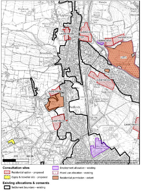
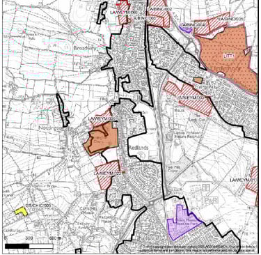
LITTLEMOOR
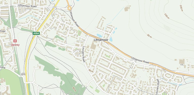
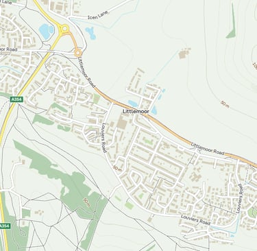
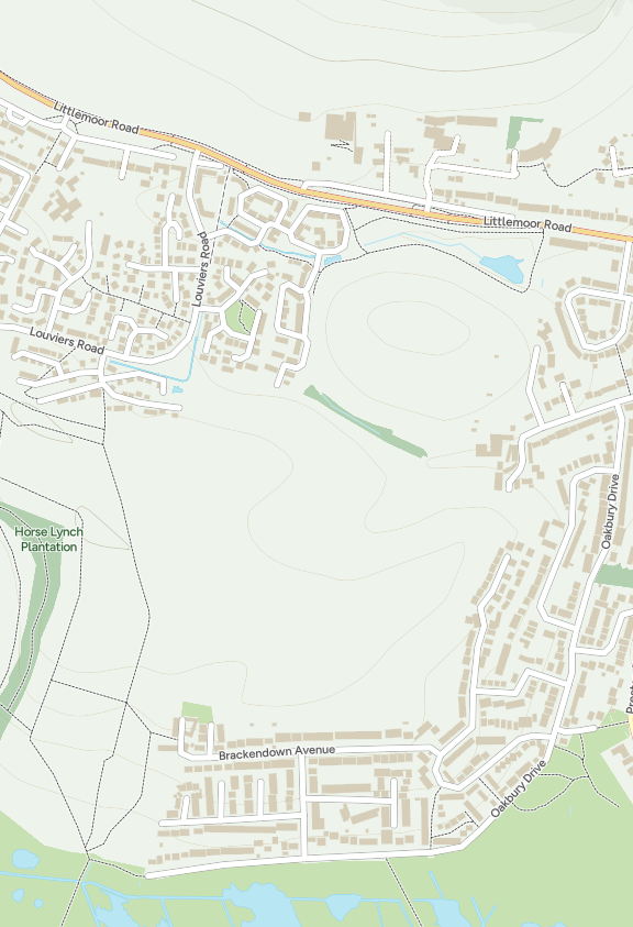
Littlemoor is a suburb on the northern edge of Weymouth, around two miles from the town centre, and lies within the Littlemoor and Preston (ward) of Dorset Council.
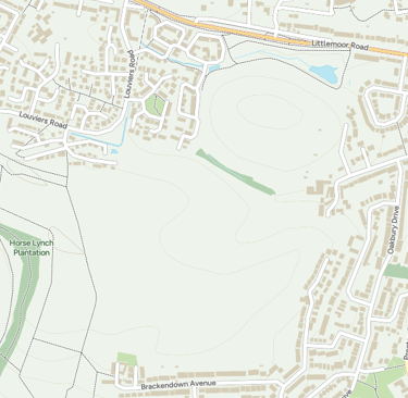
Historically, it has been surrounded by open countryside and woodland, including Teddy Bear Woods (Horse Lynch Plantation) and the Lorton Meadows Nature Reserve, giving it a semi-rural character despite its proximity to the town.
In recent years it has seen housing growth and infrastructure pressure, but remains an identifiable community with local shops, green spaces, youth facilities and a strong local identity.
This page focuses on how the proposed housing sites under the Local Plan affect Littlemoor, not just where the homes might go, but how they may change the character, services and landscape of the area we call home.
When commenting, refer to the relevant sections of the NPPF, paragraphs 176 to 182 for the AONB, 179 to 182 for biodiversity, 206 to 208 for archaeology, and 111 for transport. Citing these paragraphs ensures your response is treated as a justified issue, which the planning inspector must consider during the examination.
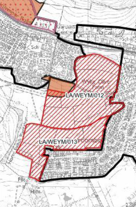
There are other nearby sites within the Littlemoor ward boundary, including several in Bincombe, which are covered separately. One further site, LA/WEYM/012 (Wyke Oliver Farm North), sits between Preston and Littlemoor and will be discussed under both sections (see below) as it affects both communities.
LA/WEYM/012 – Wyke Oliver Farm North
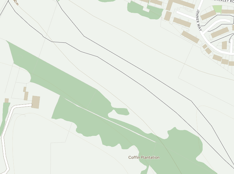
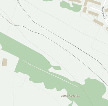
Wyke Oliver Farm North is one of the largest proposed development sites in the Weymouth area, positioned between Littlemoor and Preston on farmland that slopes down towards the Lorton Valley. Dorset Council lists the site as capable of delivering around 554 homes together with open space and a potential extension to the Lorton Valley Nature Park. The land is currently open countryside, crossed by hedgerows and drainage channels and bordered by Wyke Oliver Road to the west.
The council’s own assessment recognises that the site sits in an elevated position and that parts of it are prone to surface-water run-off. It forms part of the catchment feeding the springs and streams that eventually flow through the Lorton Valley and Lodmoor wetlands. The slope, combined with heavy clay soils, already causes flooding at points on Wyke Oliver Road and adjoining properties. Residents have long argued that large-scale building here would worsen drainage and traffic conditions, and that road access is poor for a site of this scale.
This land also frames the visual approach to Weymouth from the east. Development on such a prominent hillside would be visible from the AONB ridges above Preston and from across the Lorton Valley, potentially eroding the town’s green setting. Public footpaths run through and around the fields, linking to the Nature Park and countryside beyond.

Under the National Planning Policy Framework (NPPF), several key policies apply. Paragraphs 176–182 require local authorities to give great weight to conserving landscape character and scenic beauty, particularly where development affects the setting of an Area of Outstanding Natural Beauty. Paragraph 167 requires a sequential approach to flood risk, steering housing to lower-risk land wherever possible. Paragraphs 179–182 expect councils to protect and enhance ecological networks and deliver at least 10 per cent Biodiversity Net Gain (BNG), a measurable improvement in wildlife habitat secured for at least 30 years. Paragraph 111 states that development should be refused where the impact on the road network would be severe.
When commenting on this site, you may wish to:
ask the council to publish a full flood-risk assessment and drainage strategy, including how surface water from new roofs and roads will be managed before it reaches Wyke Oliver Road;
request a landscape and visual-impact assessment showing how development would affect views from the Lorton Valley and the AONB hills;
seek a biodiversity and green-corridor plan that proves a 10 % net gain can be achieved on-site and that the existing ecological connections to the meadow are maintained;
call for an independent transport assessment covering access, traffic flow and pedestrian safety on Wyke Oliver Road and Preston Road;
and ask that archaeological and heritage features, if any, are recorded and preserved before allocation.
When writing your response, refer to the relevant NPPF paragraphs, 176 to 182 for landscape and AONB, 167 for flood risk, 179 to 182 for biodiversity and 111 for transport. Linking your comments to these policy references ensures they are considered as soundness matters during the plan’s examination.
My good friend Glenn has written extensively about Wyke Oliver Farm North on his own community website, offering a detailed look at the site, the evidence, and the wider implications for Weymouth’s future growth.
You can read his full analysis here: 👉 Weymouth Neighbourhood Plan Democracy – Wyke Oliver Farm North